| Not Sustainable |
| cars cars cars |
| environmental damage |
| oil dependance |
| paved over |
| road infrastructure |
| sprawl |
| usage |
|
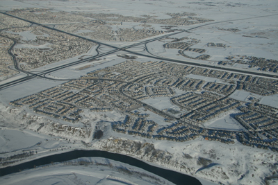
sorting by uses Calgary has done a great job of sorting the city into sections based on usage, including residential, commercial and industrial areas, just like the popular computer game SimCity. However, this means that people must drive to get to most destinations.
|
|
|
|
|
|
|
|
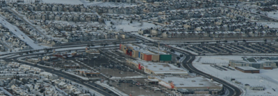
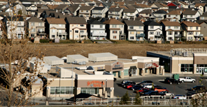
We can look to other areas within Calgary to solve this problem. For example, 17th Avenue along the Beltline District gets busy with car traffic, but there are potential exit points at every block leading in all directions. Also, people are able to park and walk to the shops and restaurants on this street, or even walk in from residential areas located close by. There are no residential units at the 130th Avenue shopping centre. My friend and I could have walked there, but it would have taken forty five minutes each way to do so from her place. Considering the amount of time spent sitting in stopped-up traffic, perhaps this would have been the more efficient way to go.
|
|